In the SCALAR system we collect more than 10 million information about atmospheric discharges since 1998. With processing different data we could made different statistics that benefits companies and people. Information about atmospheric discharges we use to make maps of storm days, high-resolution strike density maps, maps of the maximum values of lightning density and for other analyzes.
Scope
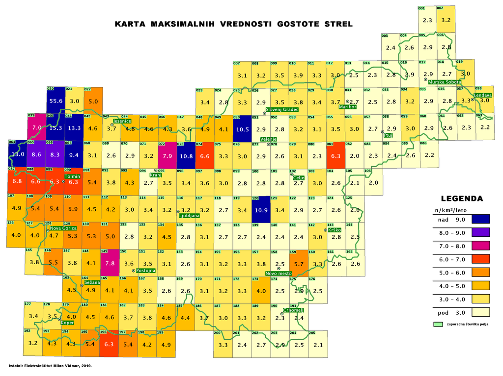
Based on the archival data about lightning strikes we can make map of stormy days, high-resolution map for strike density, map of maximum values of lightning density and other analyzes. These maps are very useful for companies to plan their activities.
- Energy- when planing positions of overhead power facilities and protecting against lightning strikes (electroenergetics, pipeline, oil companies, ...)
- Design and construction - for designing building protection against lightning strikes is according to the regulations on the protection of buildings against lightning strikes mandatory use map of maximum value of strike density
- Research and development - as an input data in research and analysis of the exposure of objects and areas against atmospheric discharges
- Insurance - creatnig pacakages based on the exposure assessment for certain areas for atmospheric discharges
- Statistical analysis - statistical analyses of the exposure areas of lightning strikes and system analysis